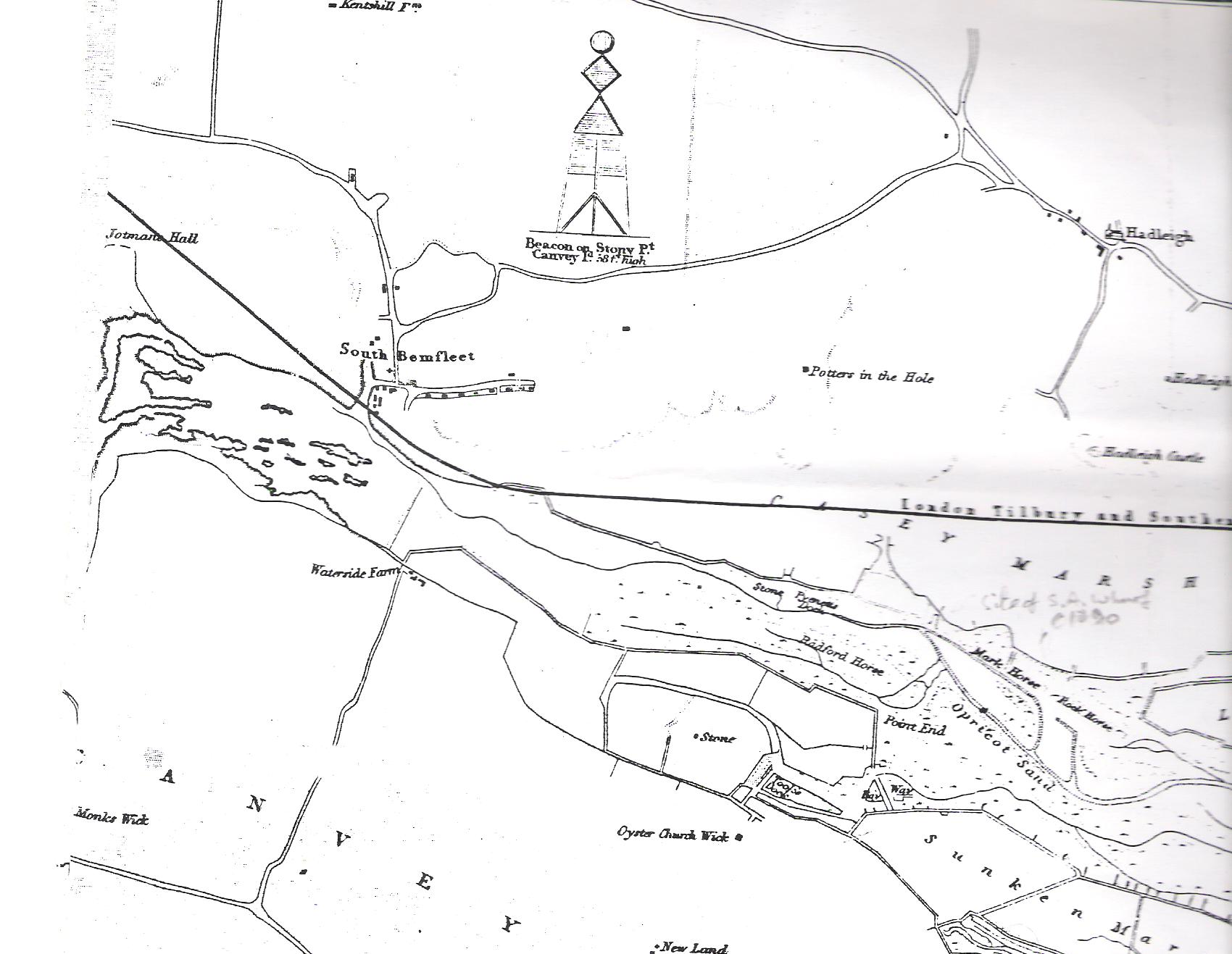
Hadleigh Ray
Pyenetts Dock

Beneath the downs in Hadleigh Ray on an Admiralty chart of 1838, corrected to 1863, of the lower Thames, is marked a dock. It was known as Pyenetts Dock.
The dock is not shown on OS maps of 1805 or later ones of the 1897-8 period; however, the new Salvation Army facility, Booth’s Wharf, was marked on OS maps by the end of that century.
The chart does not detail the land other than buildings/high points that could be used for navigational purposes, however, the 1897-8 OS map shows a pathway leading inland, across the marshes (by then enclosed) and on up-hill to a building marked as Paynetts – a farm, perhaps? Note name similarities, or was one a spelling corruption?
I would be very interested indeed to garner more information about this dock, even see an old print/picture perhaps. Can anyone help?
Location-wise, the dock seems to have been in the vicinity of the point at which power cables/pipe lines cross the creek to Canvey Island, where the wall is heavily clad a little to the west of General Booth’s wharf remains. The rill running into the marshes – shown on the 1863 chart section – can still be seen, especially in wet conditions and its sea wall remains still exist on the low land between the sea wall and railway line at that point.


No Comments
Add a comment about this page