Portrait of Castle Point, 2016
Castle Point has by far the lowest proportion of green space in Essex

Castle Point has - by far - the lowest proportion of green space in Essex
© Crown Copyright

Percentage of people 65+ by district
© Crown Copyright

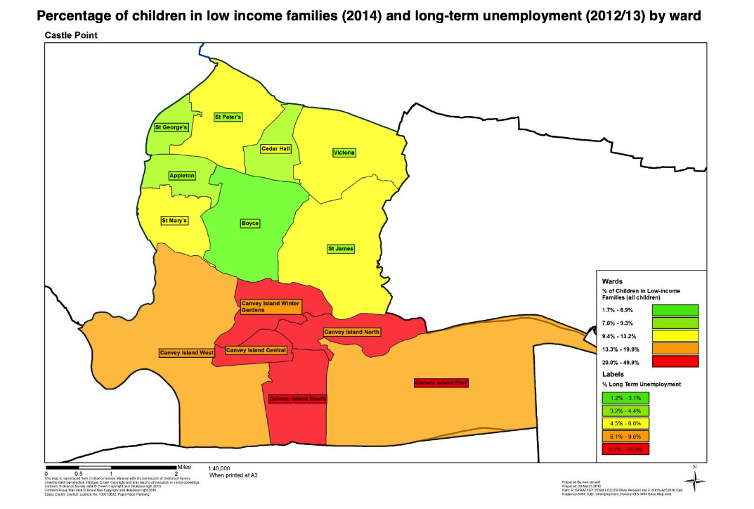
Percentage of children in low income families compared to long-term unemployment
© Ordnance Survey Crown Copyright
Castle Point, England, United Kingdom
This report was published in May 2016 as:
“Essex Local Authority Portraits”
A product of the Essex Joint Strategic Needs Assessment (JSNA)
May 2016 Organisational Intelligence
The introduction of the report includes:
“The Borough of Castle Point is situated on the coastline of south east Essex and has an area of approximately 17.3 square miles.
It benefits from good links to London such as the Fenchurch Street railway line, the dual carriageways of the A13 and the A127, which link within half an hour to the M25 motorway.
Castle Point as an area has a long history but is essentially modern in character, there are a few older buildings still remaining although major re-development took place mainly between the two world wars. “
The full 25-page report is available as a download below.
There are some useful graphics, of which three examples are shown.
Note the Crown Copyright.
1} The relative lack of green space compared with the rest of Essex is noted on Page 21 of the report.
“Castle Point has a population density of 19.21 persons per hectare, the second highest district in the county.”
2} Percentage of people aged 65+ by Essex district Page 4
3} Child poverty/Long term unemployment: Page 11
Downloads
Lifestyles, health, housing, people, education, transport and employment
JSNA / www.essexinsight.org.uk
Comments about this page
Add your own comment
A work in progress which helps to visualise Castle Point is Liam Heatherson’s draft YouTube video: https://youtu.be/f8c2fV06g-I
Liam is part of Canvey’s prize-winning team called Beyond The Point.
Add a comment about this page